
Evan with OpenStreetMap versus the New York Times
Unhappy with the NYT's map, I spiced up Open Street Map. Now OSM is running circles around NYT.

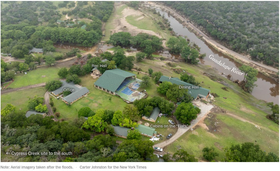
Recently a bunch of a kids died because of supremely incompetent government — recently made overly great again, and a horribly incompetent summer camp. To illustrate the camp, this is what the New York Times put out — lacking all the goodness that a map is supposed to have.

Unsatisfied with one vague map, the New York Times, put out a second aerial map with even less data and with deceptfully labeled “Cabin on the Flats,” which actually includes all the cabins they’re not showing behind the tree line.
I found their maps to vague; I wanted to do better. I used OpenStreetMap and some quick cross referencing of the Camp Mystic brochures and other news data and I came up with this,

Viola. Now you can see every building. The yellow outline is the flats which is where the campers were. You can see my digitized contributions on Open Street Maps. But here is an image generate from it without any satellite imagery.

Log in if you want to see the total campsite digitized (or most of it anyway).
Now when the news mentions Bubble Inn you can quickly find it. This is the cabin which had all of 13 of the girls which inhabited it swept away in flood waters. You can read more about that in the coverage by the New York Post.
If you want to see both camps together the Camp Mystic Guadalupe River, and Camp Mystic Cypress Lake, then here is a map for you! (Requested in pvmsg)
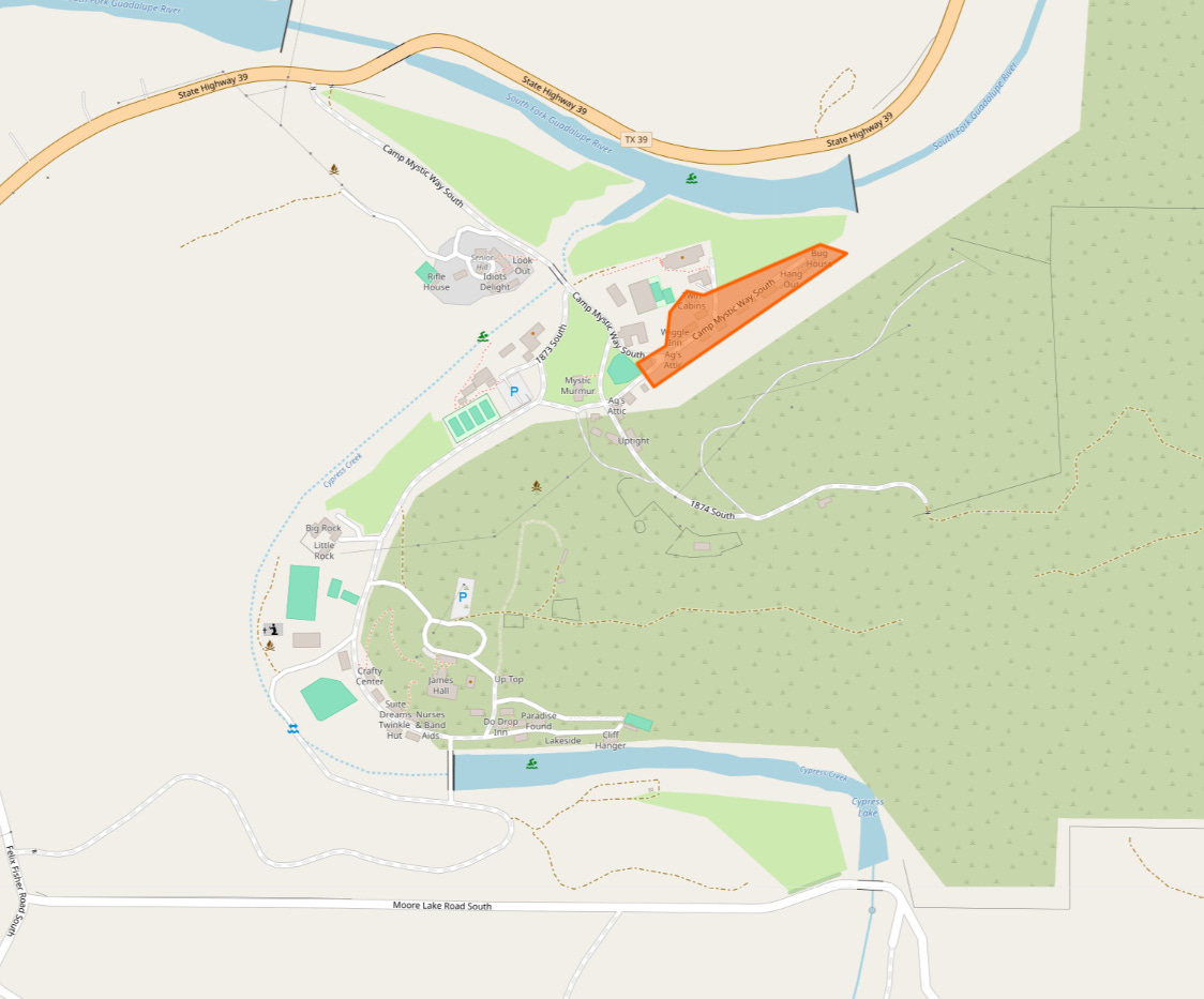
The highlighted area is the “Cabin on the Flats” of Camp Mystic Guadalupe River. Compare that to the label the NYT placed above.
Here is a copy of the USGS 3D Elevation map of the region. You can see the cabins for the kids are square in the river’s trough.
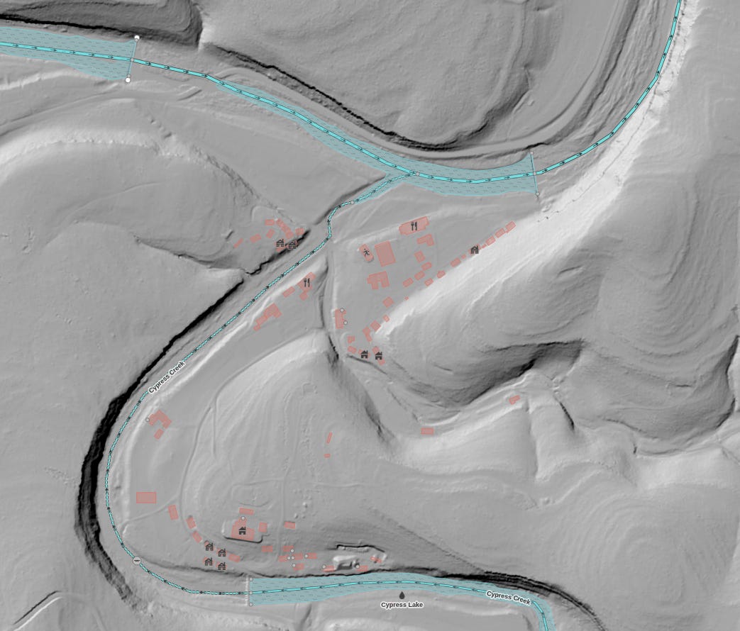
I overlaid it with the digitized buildings.
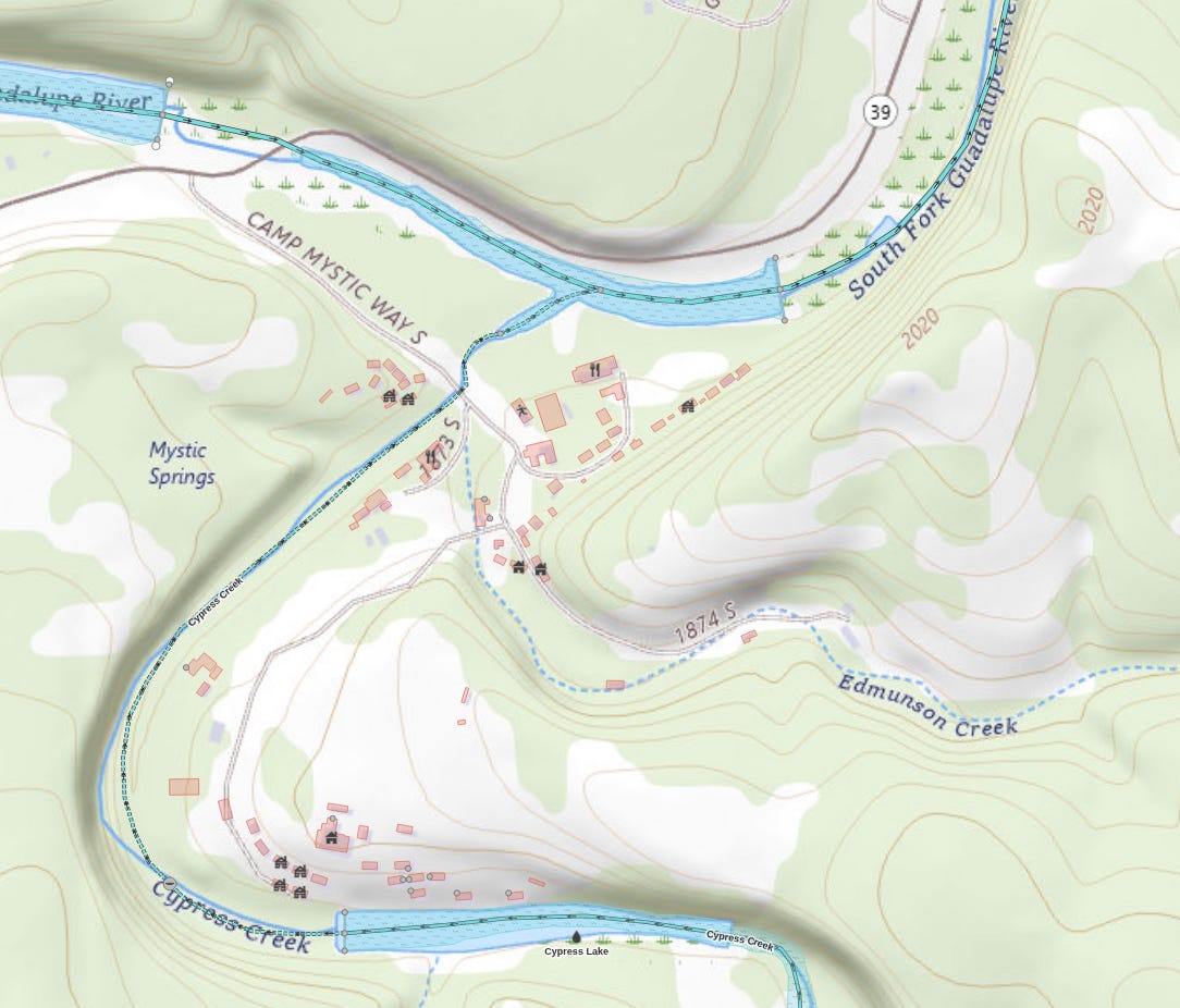
Also worth pointing out that there is an extinct creek that some sources show running right through the camp site called Edmunson Creek. This is an overlay on the USGS The National Map Topographic.
For comedy, this is the level of detail you get with Google. If you’re interested to learn more about mapping and how you can contribute, comment below and I’ll write more about OpenStreetMap.
I have follow up to this article where I write about the poor reception I got on r/Texas and my general experiences on Reddit. I have another article about Camp Mystic entitled “Camp Mystic, cabins, and the 100 year flood plane”
Scientific Journal of Objective Truths and Proof 2025:7-7.0.0
All I see zoomed in is the overall label "senior hill". I fiddled around and it says this when I click on a cabin:
"Way: 1413097277
Version #4
#mapbox_editing reverted profanity edits
Edited 1 day ago by Vladislav Konoplev
Changeset #168911181"
https://www.openstreetmap.org/way/1413097277/history/4
Version 3 is yours, version 4 is "Vladislav Konoplev"'s
Great resource regardless and it isn't a huge deal, just wanted to let you know
FYI for some reason on the live openmaps link there are no longer labels for each cabin in senior hill, just says "senior hill". Seems like it was edited out somehow. Love the resource though, thanks for sharing it.